 http://pubs.usgs.gov/fs/fs-004-03/
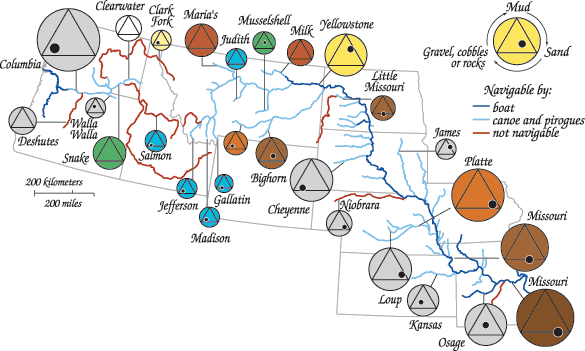
This map takes a look at water observations made by Lewis and Clark. The color of each circle denotes the color of the water (grey being no distinct color was noted). Within each circle is a triangle, and within each triangle, a black dot. The location of the black dot inside of the triangle describes the composition of the seabed.
No comments:
Post a Comment